
Informacion meteo


- Details
- Category: Metereología y Oceanografía
- Published on Monday, 24 November 2014 15:41
- Hits: 2433
CMC-GDPS Analyses / Europe (mesh: 25 km interpolated to 33 km)
How to Read a Weather Map
- Details
- Category: Metereología y Oceanografía
- Published on Monday, 10 November 2014 10:11
- Hits: 2533
How to Read a Weather Map
Weather maps provide a simplified depiction of the current or predicted weather of an area. The most common weather map you will come across is surface analysis, shown here. To read a surface-analysis weather map, follow these guidelines and tips.
-
Understand general concepts of the weather. What most people are concerned with is precipitation, which, in meteorology (the study of weather), is any form of water that falls onto the Earth's surface. Forms of precipitation include rain, hail, snow, and sleet. High pressure implies fair weather and low pressure is usually associated with precipitation.
-
2Find a weather map.Watch out for one on the TV news, online, or in your local newspaper. (Other sources may include magazines and books, but they
Bureau of Meteorology introduces new weather language
- Details
- Category: Metereología y Oceanografía
- Published on Friday, 07 November 2014 05:48
- Hits: 2326
Bureau of Meteorology introduces new weather language
Updated
The Bureau of Meteorology (BoM) is using new terminology to make it clearer for the public to understand rainfall forecasts.
When predicting rain, the BoM will now use a percentage rather than words to describe the chance of daily rainfall.
The forecasts will utilise the new Meteye information system which is helping the Bureau with more exact forecasting across the country.
Senior forecaster Rick Threlfall told 612 ABC Brisbane's Rebecca Levingstonthat the change is set to make things clearer on the
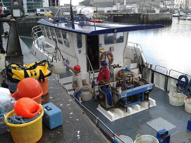
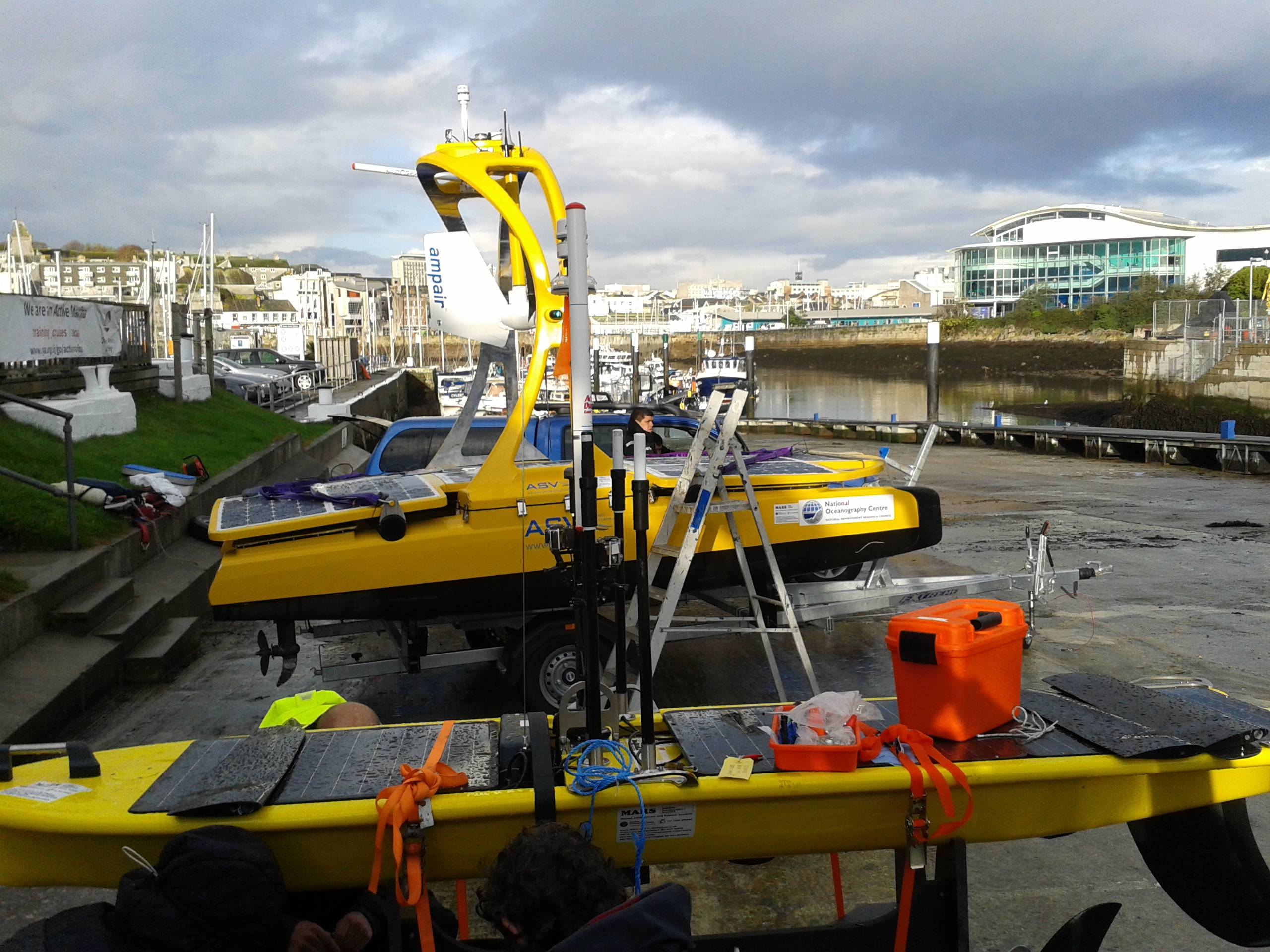
Robot Vehicles Embark on Fish Tracking Mission
- Details
- Category: Metereología y Oceanografía
- Published on Friday, 07 November 2014 05:52
- Hits: 2495
Robot Vehicles Embark on Fish Tracking Mission
Three marine robot vehicles have been launched from Plymouth today to undertake a fish tracking mission in and around new Marine Protected Areas (MPAs). Scientists from the Marine Biological Association (MBA) and engineers from the National Oceanography Centre (NOC) are working together on this pioneering project to study how fish use these areas on a day-to-day basis.
Using acoustic pingers, plaice, sole, brill and rays are being tracked at sea by the ocean robots programmed to patrol a large area of the MPAs there are also a number of seabed listening stations which work in concert with the ocean robots.
The three
Rayos
- Details
- Category: Metereología y Oceanografía
- Published on Friday, 07 November 2014 05:42
- Hits: 2616
Huge bolts of lightning over Adelaide Airport captured by Rowland Beardsell in March 2013, that features in the calendar. Source: Supplied